THE Tsikoane plateau is not only home to breathtaking views of snowcapped peaks of mountains but also a household to a legacy left by dinosaurs that roamed our land millions of years ago.
travel
July 26, 2023
BY MAPAMELA KHANYELA
4 min read
Tsikoane, the beauty of Leribe
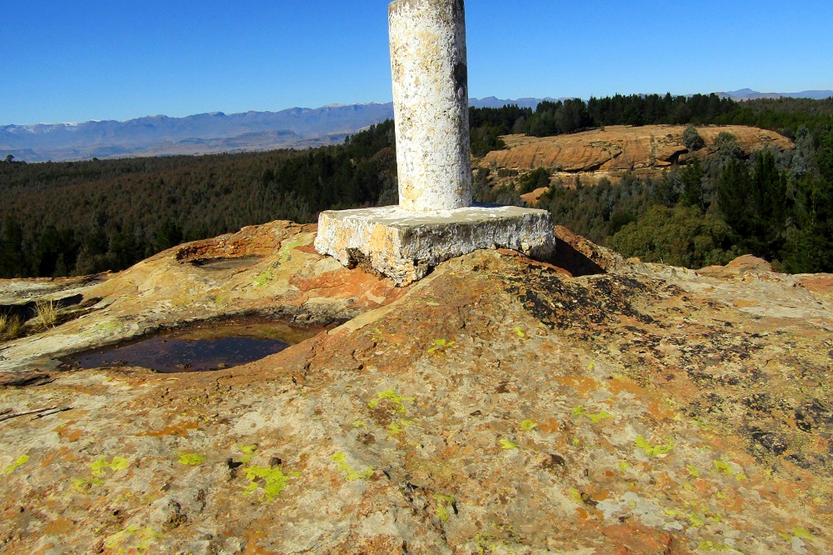
The pillare at the summit of the plateau
Story highlights
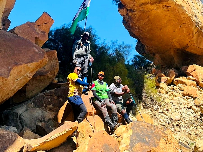
Climbing the Tsikoane plateau has always been my goal, and I had no idea it was that beautiful until Saturday, July 1, 2023, when I ascended it with two gentlemen, namely, Rethabile Ramokone and Mr. Morolong Thoothe, who are experienced District Culture Officers in Leribe.
The Plateau is located about 9.9 kilometres from Hlotse, the capital town of Leribe.
Our journey began in Hlotse, and we drove to Tsikoane, a rural settlement, where the plateau is situated.
The morning sun's rays could not provide enough warmth as it was still extremely cold.
We had a light breakfast before we started our journey to the top of the plateau.
There are about six passes to the summit of the Tsikoane plateau, but because we were first heading to the Menoaneng Caves to view dinosaur footprints, we had to use the Linareng Pass.
As we walked, Ramokoane told me that they were in advanced stages of documenting the tourism attractions of Leribe to serve the interests of tourists.
"Our message is clear: Leribe is a tourism hub in Lesotho. We have a wealth of historical monuments, including this plateau. In 2024, we will be celebrating 200 years since the formation of the Basotho Nation. Our objective is to thoroughly document these important heritage sites for the nation and our tourists," he said.
To reach dinosaur footprints, we had to walk through a tough terrain. We followed treks on the slopes of the plateau, taking us through thorny bushes.
We passed a number of caves with deposits of clay on the ground.
"These are signs that people used to reside here," explained Ramokone.
The caves were also a home-based rock dassie because there were fossil-like objects that Ramokone described as urine used by traditional doctors.
We finally arrived at an impressive dark cave with dinosaur footprints; the footprints were on the roof of the cave. Ramokone described them as negative dinosaur footprints.
I counted more than 20 visible footprints; some seemed small, others looked like human hands, and one had three big fingers.
It seemed impossible to touch them because they were metres away from the ground.
Ramokone clarified that the tale of the dinosaurs was not a myth but a factual story of what happened all those millions of years ago, and the beauty of the footprints has enslaved many to visit the plateau again and again.
"The people of Tsikoane named these caves Menoaneng because of the dinosaur footprints that look like human fingers," explained Ramokone.
We continued our journey to the highest peak. We passed through dense forests, abandoned cattle posts, beautiful rock pools, ruins, and birds sitting on strange rock formations on our way to the peak of the plateau.
The highest point of the plateau was marked with a white pillory. Upon our arrival at the summit, it was evident we were destined to see gorgeous places.
Due west of the Pleateu, 12.7 kilometres away, stands the town of Maputsoe. On the east are the famous Qoqolosing Mountain and the snowcapped mountains of Leribe. The summit offers endless, fascinating aerial views.
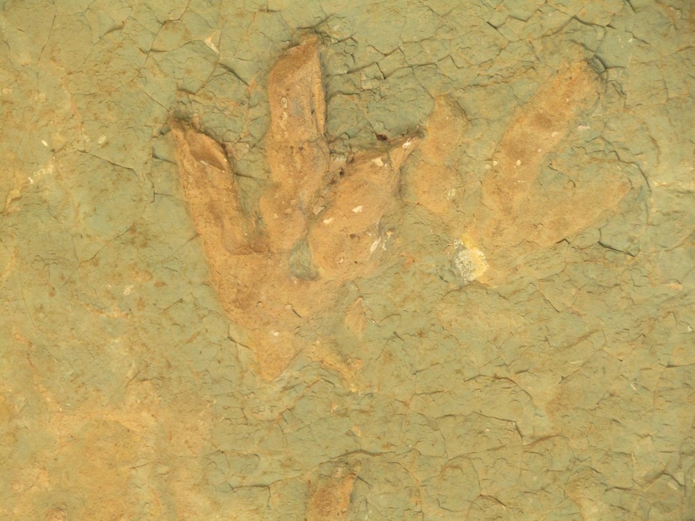
The footprints of dinasours at the summit of the plateau
Enjoy our daily newsletter from today
Access exclusive newsletters, along with previews of new media releases.
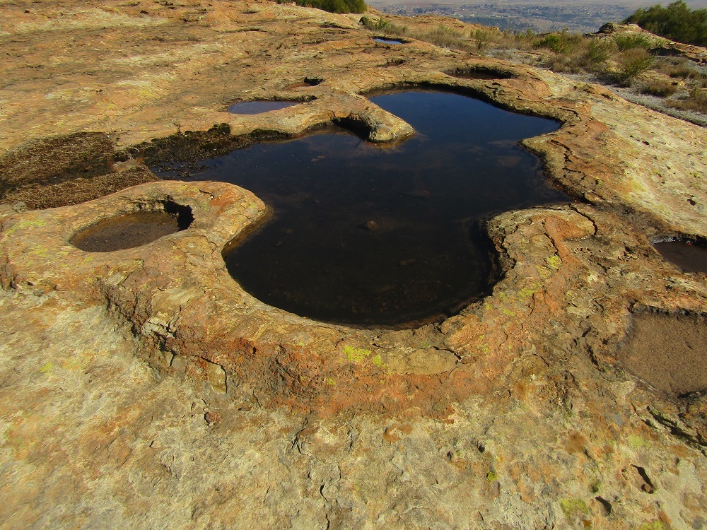
The Rockpool at the plateau
There are also a number of rock pools at the highest point of the plateau.
While at the summit, Thoothe showed me historical places and explained their relevance to the history of Leribe.
"That is Lisemeng, a settlement where Basotho men were forced to surrender their guns in 1880–81 during the Gun War; unfortunately, the place is now occupied by individuals for their different purposes," he said.
He further pointed to a mountain in Free State, describing it as Joalaboholo that was occupied by Batlokoa, who were arch rivals of King Moshoeshoe I, the founder of the Basotho nation.
"Batlokoa men who stayed on that plateau used to pretend to be drunk, then come down to Basotho villages, gather information, and go back," he said.
From the summit, we walked back to the village, and coming down was steep and challenging. Our next port of call was at the district administrator’s office in Hlotse, where we summed up our journey.
At the entrance of the DA’s office, there is a statue of a kneeling white soldier carrying a bag, ammunition, and a gun.
Thoothe explained that he was an English soldier who fought in the Gun War against Basotho, adding that his office is yet to establish why the statue was at the centre of Hlotse.
In conclusion, a guided tour to Tsikoane requires prior arrangements with Tsikoane Adventurers, who know all the treks on the plateau.
I learned on that day that there is a 9-hour trek on top of the plateau, and for that trek, adventurers should carry enough water and food.


